River Runner
Watch the path of a raindrop from anywhere in the contiguous United States
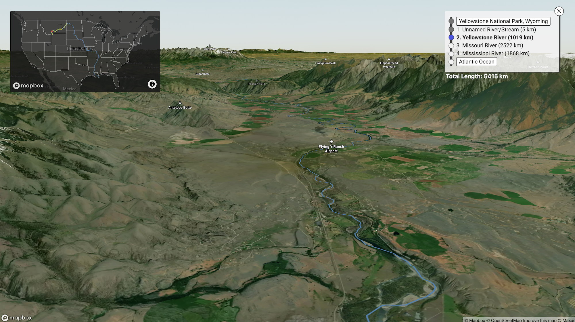
 river-runner.samlearner.com
river-runner.samlearner.com
river-runner.samlearner.com
The person that tweeted it had someone reply that on their farm in southern missouri one of his fields drained south and went into the white river going south through Arkansas to the Mississippi River and the field literally across the road drained north and went into the Meremec River and flowed northeast back to St Louis and into the Mississippi there.Pretty cool that the water in Browning MT makes its way to the Mississippi whereas the water in Jackson, 40ish miles from the river as the crow flies, does not. I know why. It's just interesting.
I remember looking at a watershed map of MS one time and basically the water on one side of the Kroger parking lot in Madison goes to the Mississippi River, and the water on the other side goes to the Pearl River.Pretty cool that the water in Browning MT makes its way to the Mississippi whereas the water in Jackson, 40ish miles from the river as the crow flies, does not. I know why. It's just interesting.
Not to derail the thread, but less and less of the mountain snow is making it back down to the Salt Lake, and it is at an alarmingly low level. It's an overpopulation issue. The people are using more water than they have. As the lake level drops, less and less snow will form on the mountains, making the problem worse, as there will be less runoff to refill the lake. Then more and more heavy metals from the lake will be released into the air, making SLC unliveable.Never paid attention that the ski resorts in Utah drain into the Great Salt Lake and there is no outlet. Pretty much the northern half of Utah and NE Nevada have landlocked seas that they drain into.
I think the whole programming is based off of topo mapping the terrain and doesn’t take into account changes based on structural factors.This has a fair number of flaws. Honestly I am surprised it was released to the public as is. For example It didn't recognize the change from Alabama River to Mobile River. I couldn't get it to ever pick the Tensaw River at the split. For some reason it says everything going out the Mobile River ends in Justin's Bay. Which is just laughable.
Then I tried the Conecuh River. I missed it becoming the Escambia River, and skipped Escambia Bay before it got to the Gulf of Mexico.
Wait!! Something on the internet isn't 100 % accurate??This has a fair number of flaws. Honestly I am surprised it was released to the public as is. For example It didn't recognize the change from Alabama River to Mobile River. I couldn't get it to ever pick the Tensaw River at the split. For some reason it says everything going out the Mobile River ends in Justin's Bay. Which is just laughable.
Then I tried the Conecuh River. I missed it becoming the Escambia River, and skipped Escambia Bay before it got to the Gulf of Mexico.
