NMSC Skycam now live.

Hugh's Burner Phone

Well-known member
Aug 3, 2017
4,486
3,803
113
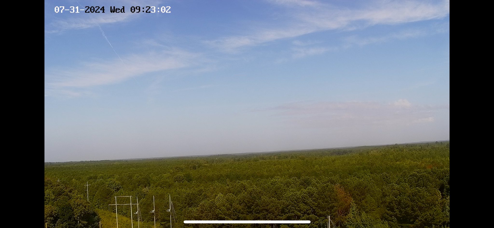
From dream to reality over a year of planning, dreaming, and setbacks have paid off. Our first camera is now active near Maben with our Adaton camera west of Starkville going live later today. We have more planned for later this summer. For those of you that have donated, a massive thank you. You made this happen. No way it's done otherwise. For those of you that want to donate or become a business sponsor, you can go to www.NMSCAS.org and select the donate or sponsor button. We want these across the state and literally every dollar counts and every part of your donation goes to this.


Hugh's Burner Phone

Well-known member
Aug 3, 2017
4,486
3,803
113
And now the Adaton camera is active. All camera feeds will be accessible at the link below. We still have a some fine touches to do the page which we should get some later this evening as well as add some overlays to the video feeds themselves.

 
  • Like
Reactions: Drebin and Marler

MStateU

Well-known member
Nov 15, 2009
678
1,052
93
From dream to reality over a year of planning, dreaming, and setbacks have paid off. Our first camera is now active near Maben with our Adaton camera west of Starkville going live later today. We have more planned for later this summer. For those of you that have donated, a massive thank you. You made this happen. No way it's done otherwise. For those of you that want to donate or become a business sponsor, you can go to www.NMSCAS.org and select the donate or sponsor button. We want these across the state and literally every dollar counts and every part of your donation goes to this.


What are the directional orientations of these cameras? I will probably look at them occasionally and just want to know what direction I’m looking. Also, are these on water towers or cell towers or what? Just curious.
 

Hugh's Burner Phone

Well-known member
Aug 3, 2017
4,486
3,803
113
What are the directional orientations of these cameras? I will probably look at them occasionally and just want to know what direction I’m looking. Also, are these on water towers or cell towers or what? Just curious.
They are generally going to be pointing west to southwest. They are PTZ cameras so we will be able to move them to face a storm as one is in the area. These first two are on communication towers at electrical substations. The next 5 will be a mix of those, stand alone towers, and antennas on top of tall structures such as the grain elevator in Greenwood where one will be soon.

Last nigh we got permission from a tower leasing company to use any of their towers we wanted and I got the name of another company that may do the same. I am sure those are a mix of cell towers, radio towers, etc. They will be sending me a map of their tower locations later today.
 

Hugh's Burner Phone

Well-known member
Aug 3, 2017
4,486
3,803
113
Well damn, I was going to suggest The Pack put together a pledge of some kind to make a donation or sponsorship, but, now I see ELite Dawgs beat us to it. What are we gonna do about it?

Was It Over When the Germans Bombed Pearl Harbor?
We're planning on a **** ton of cameras. There's room for everybody. We are getting ready to put up another 5 cameras over the next few weeks, but then we will be on a hold pending additional funds. We are increasing the places giving us permission to install cameras as soon as we get the funding to buy them and cover the monthly operating costs. Fingers still crossed we can find somebody to donate the tower climbs on these new sites. All of the ones we are putting up now the climbs are covered by the tower owners which is huge.
 

FormerBully

Well-known member
Sep 2, 2022
1,829
2,836
113
We're planning on a **** ton of cameras. There's room for everybody. We are getting ready to put up another 5 cameras over the next few weeks, but then we will be on a hold pending additional funds. We are increasing the places giving us permission to install cameras as soon as we get the funding to buy them and cover the monthly operating costs. Fingers still crossed we can find somebody to donate the tower climbs on these new sites. All of the ones we are putting up now the climbs are covered by the tower owners which is huge.
How far can the cameras see?
 

Hugh's Burner Phone

Well-known member
Aug 3, 2017
4,486
3,803
113
How far can the cameras see?
The ones we have now are about a 100' high and they look to be able to see to the horizon. We will have some in the delta up close to 200'. One of our active feeds has a water tower in the distance and I am trying to find it on googlemaps to see the distance, but I haven't found it yet. If I were to throw out a guess I would say these two can see 5-7 miles Here is a screen grab. Excuse the buffering signal. Our internet at work is having issues today.


Annotation 2024-08-02 110747.png
 
  • Like
Reactions: FormerBully

Hugh's Burner Phone

Well-known member
Aug 3, 2017
4,486
3,803
113
Here are the rough numbers on what doing this costs:

Camera $600
Software $40 per month per camera
If we have to pay for the tower climb ourselves then that adds ballpark $1,000 a camera so we hope we can make those few and far between. Right now we still have locations where the climb is covered so we are concentrating on those.
 

MStateU

Well-known member
Nov 15, 2009
678
1,052
93
The ones we have now are about a 100' high and they look to be able to see to the horizon. We will have some in the delta up close to 200'. One of our active feeds has a water tower in the distance and I am trying to find it on googlemaps to see the distance, but I haven't found it yet. If I were to throw out a guess I would say these two can see 5-7 miles Here is a screen grab. Excuse the buffering signal. Our internet at work is having issues today.


View attachment 620835
See if it’s the tower on the campus of the old wood jr college. About 1/4 mile north of intersection in mathiston. That’s SW of maben.
 

Hugh's Burner Phone

Well-known member
Aug 3, 2017
4,486
3,803
113
See if it’s the tower on the campus of the old wood jr college. About 1/4 mile north of intersection in mathiston. That’s SW of maben.
I think the camera is actually pointing north now. The only one I can find is in Mantee and that is 11 miles but I really don't think that is it. My guess is it is one at Clarkson or Cumberland 3-5 miles away and I just can't find it. I messaged our tech guy that can control the cameras to see what he can find.
 

MStateU

Well-known member
Nov 15, 2009
678
1,052
93
Oh. There’s one about a quarter or half south of East Webster high school. Big curve in bland road.
 

MStateU

Well-known member
Nov 15, 2009
678
1,052
93
Oh. There’s one about a quarter or half south of East Webster high school. Big curve in bland road.
 

Hugh's Burner Phone

Well-known member
Aug 3, 2017
4,486
3,803
113
Oh. There’s one about a quarter or half south of East Webster high school. Big curve in bland road.
That's it. That tower is 2.75 miles from the camera and it can see beyond it so I am guessing this one can see about 5 miles on ground level and it will be able to see things in the air further than that. I'm going to think it will be able to see storm bases out to 6-8 miles at least and the cameras have a 16X optical zoom on them to help pick out details at distance.
 
Get unlimited access today.

Pick the right plan for you.

Already a member? Login