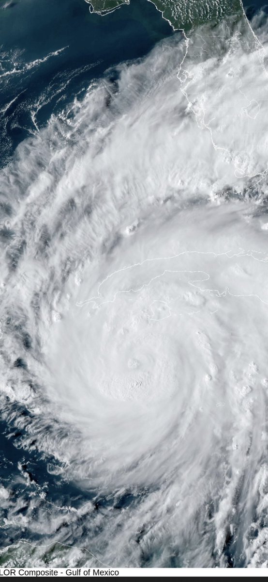
Last night Ian began rapid intensification as it moved into a very favorable environment of low shear and warm sea surface temperatures and currently has winds of 75mph. This is expected to continue as it moves northward towards Cuba and then the US and could make a run at category 4. The forecast track is starting to solidify to a Florida landfall somewhere between Tampa and Tallahassee. Based on current forecasts, impacts will be very limited for the MS/AL Gulf coasts. As the storm draws closer surf will be heavy and rip currents will be an issue so if you have a beach trip planned for the second half of this week be very mindful of that if you get in the water and don't be surprised if you see double red flags. Aside from that those of us here will be hard pressed to even know there is a storm. If you are in the path of the storm there is still hope that right before it makes landfall it starts to become impacted by wind shear which weakens it down to below major hurricane status. Still a lot at play there so prepare as if you will be impacted by a major storm and then consider yourself fortunate if you are not.