OT: Another storm gonna whack FL

MtNittany

Well-known member
Oct 12, 2021
1,338
1,813
113
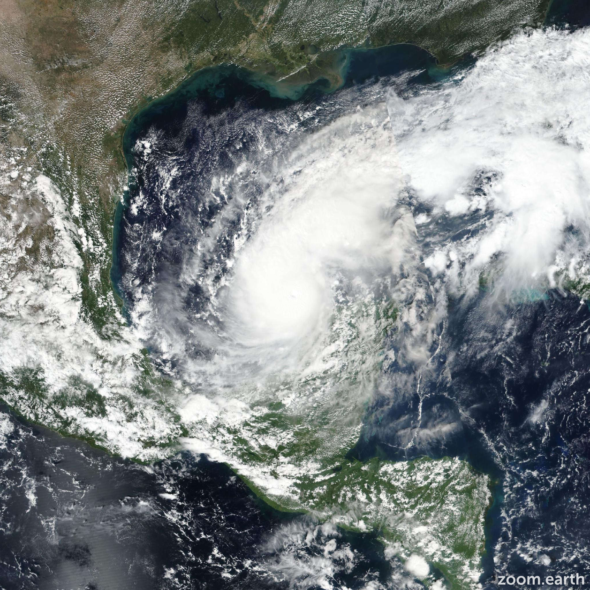
Latest Euro Model. Landfall should be Thursday morning. Be on your toes and make your preps PSU Floridians.

 
Last edited:

LionJim

Well-known member
Oct 12, 2021
9,652
13,272
113
Moving real slowly, that’s disturbing.

For those in Milton’s path, please be proactive in regards to your safety. Things can go bad quickly.
 
  • Like
Reactions: PSU87 and BobPSU92

Tom McAndrew

BWI Staff
Staff member
Oct 27, 2021
48,431
37,278
113
[Image of Rainfall Potential]


"RAINFALL: Rainfall amounts of 5 to 10 inches, with localized totals up to 15 inches, are expected across portions of the Florida Peninsula and the Keys through Wednesday night. This rainfall brings the risk of considerable flash, urban, and areal flooding, along with the potential for moderate to major river flooding."
 

Lionville

Well-known member
Oct 19, 2021
1,119
1,699
113
[Image of Rainfall Potential]


"RAINFALL: Rainfall amounts of 5 to 10 inches, with localized totals up to 15 inches, are expected across portions of the Florida Peninsula and the Keys through Wednesday night. This rainfall brings the risk of considerable flash, urban, and areal flooding, along with the potential for moderate to major river flooding."
Then there’s the potential storm surge for those near the beaches and bays.
 

PrtLng Lion

Well-known member
Oct 14, 2021
914
1,387
93
I feel bad for the folks on the west coast and panhandle. My area is still in the cone (barely- Broward county) but don't need the center of the storm to pass overhead to get heavy rain and wind damage.

Two of my kids are in Gainesville... unlike USF and UCF, UF still hasn't made a statement about classes this week. They took some major **** for Helene, where they canceled classes the night before and lots of kids were without power for several days.
 

Big_O

Well-known member
Oct 12, 2021
894
1,334
93
Right now both our homes are right along the center line. But it’s 3 days away, so anything can happen.
 

MtNittany

Well-known member
Oct 12, 2021
1,338
1,813
113
I don't remember many west to east storms crossing FL. Lots of east to west ones though. Parts of the west coast are going to get battered. Again. But the east coast could see 90 mph winds. Everything is backwards. The bad/good side of the storm is reversed for the east coast.
 

Rick76

Well-known member
Oct 13, 2021
1,994
5,231
113
Navy pal retired to a place south of Tampa. There hadn't been a hurricane there in 40 years. Now they've had two in the last three years with another looming.
 
Sep 17, 2024
253
212
43
Best of luck to all of this board’s FLA residents, full time and part time.

I fear what will happen to homeowners insurance rates after Helene and this storm.
 
  • Like
  • Sad
Reactions: PSU87 and LionJim

stater02

Member
Jan 17, 2022
97
173
33
I’m down in Naples. Left for Ian but going to ride this one out unless it starts tracking south. Feeling awful for the folks up in Tampa. They’re getting double tapped.

Heard a crazy stat the other day: in the past 8 years, there have been 8 Cat 4 or 5 hurricanes to make landfall in mainland US. There were as many (8) in the prior 57 years.
 

slwlion01

Member
Jul 24, 2023
155
191
43
I don't remember many west to east storms crossing FL. Lots of east to west ones though. Parts of the west coast are going to get battered. Again. But the east coast could see 90 mph winds. Everything is backwards. The bad/good side of the storm is reversed for the east coast.
In 2004 we had 4 in 6 weeks, I believe. Direction immaterial. it still sux. lmao(n)
 

MtNittany

Well-known member
Oct 12, 2021
1,338
1,813
113
In 2004 we had 4 in 6 weeks, I believe. Direction immaterial. it still sux. lmao(n)
Jeanne was the worst for me. I feared Andrew more, but it veered way south. Jeanne was moving at 1mph w/ 90mph sustained. That and Frances had me w/out power for about 20 days.
 
  • Like
Reactions: PSU87

Tgar

Well-known member
Oct 13, 2021
4,573
10,288
113
Cause it’s the new Mother Nature taking over
It’s the new Splendid lady come to call
It’s the new Mother Nature taking over
She’s gettin’ us all
She’s gettin’ us all.


or, at least Florida and other parts of the southeast, the Amazon, the extended fire season up north and out west, East Africa, Phoenix with those 100 days, on and on and on and on…..…
 

LaJollaCreek

Well-known member
Oct 12, 2021
3,599
7,318
113
Hopefully that low coming down can knock out some of the punch of this storm, but this one looks nasty. A direct west to east hit. My niece is on the road already leaving USF this morning to come up by me in Northeast Florida. Best of luck to those in Milton's path. Be safe.
 
  • Like
Reactions: Psu00 and slwlion01

laKavosiey-st lion

Well-known member
Oct 30, 2021
7,469
5,635
113
Best of luck to all of this board’s FLA residents, full time and part time.

I fear what will happen to homeowners insurance rates after Helene and this storm.
We’re going to help our sons when they buy their first home but already told son1 we’re not helping him buy in CA. This uninsured homes thing is gonna bury people
 
  • Like
Reactions: saturdaysarebetter

Bwifan

Well-known member
Oct 12, 2021
1,407
2,583
113
I don't remember many west to east storms crossing FL. Lots of east to west ones though. Parts of the west coast are going to get battered. Again. But the east coast could see 90 mph winds. Everything is backwards. The bad/good side of the storm is reversed for the east coast.

We were talking about this yesterday how all the storms are forming in the Caribbean and GOA (Gulf of America) this year and other than the early season storm nothing has made it across from Africa. Sahara Sands were plentiful this year and lasted much longer than normal (thankfully) due to the massive drought in Africa and kept a lid on storms forming in the Atlantic.
 

Bwifan

Well-known member
Oct 12, 2021
1,407
2,583
113
Best of luck to all of this board’s FLA residents, full time and part time.

I fear what will happen to homeowners insurance rates after Helene and this storm.
Not just FL everyone absorbs those costs as well as what will rates be in NC/SC/GA as well.
 

Bwifan

Well-known member
Oct 12, 2021
1,407
2,583
113
Up to 125mph... another 1.5 days to intensify and hasn't hit the warm water loop yet to really spin up with energy.... Hopefully Helene stirred up enough cooler water and shear that Milton weakens as it nears shore otherwise this should be a Cat 4 when it hits.
 

LionJim

Well-known member
Oct 12, 2021
9,652
13,272
113
We were talking about this yesterday how all the storms are forming in the Caribbean and GOA (Gulf of America) this year and other than the early season storm nothing has made it across from Africa. Sahara Sands were plentiful this year and lasted much longer than normal (thankfully) due to the massive drought in Africa and kept a lid on storms forming in the Atlantic.
Yeah, I occasionally read Michael R Lowry’s substack and he went deep into the Sahara dust complication.
 
  • Like
Reactions: Bwifan

PSU87

Well-known member
Oct 12, 2021
1,568
3,209
113
Jeanne was the worst for me. I feared Andrew more, but it veered way south. Jeanne was moving at 1mph w/ 90mph sustained. That and Frances had me w/out power for about 20 days.
Yes. In my 30 years here, Jeanne was the worst.

Matthew was set up to be catastrophic for the Space Coast, but turned at the last possible minute.
 

uh-Clem

Member
Jul 31, 2022
40
62
18
My daughter's wedding at the Marriott on Clearwater Beach on November 9 has already been affected by Helene and is now likely to get a second shot from Milton. Fortunately, she understands that getting upset about nature gets one nowhere. We are hoping the island gets cleaned up enough so the event is able to go on without any other issues.
 

LaJollaCreek

Well-known member
Oct 12, 2021
3,599
7,318
113
With all the rain this weekend the I4 corridor is all going to take a huge hit with down trees and limbs. Hopefully the St. Johns River doesn't do much either, but from Tampa through Orlando and then on to Daytona I imagine most of the corridor will be without power come Thursday.
 

PSU87

Well-known member
Oct 12, 2021
1,568
3,209
113
My daughter's wedding at the Marriott on Clearwater Beach on November 9 has already been affected by Helene and is now likely to get a second shot from Milton. Fortunately, she understands that getting upset about nature gets one nowhere. We are hoping the island gets cleaned up enough so the event is able to go on without any other issues.
Edit: disregard, misread the date

Man, i wish you and your daughter nothing but the best, but i think the chances of doing anything in Clearwater Beach on Wednesday are pretty slim....
Best of luck...
 
Last edited:
  • Like
Reactions: lionlover

Tgar

Well-known member
Oct 13, 2021
4,573
10,288
113
Looks like it has raised is strength from category two to category five in four hours. Wow.
 

nittanymoops

Well-known member
Oct 31, 2021
387
643
93
He did say November, but even that is at risk depending on storm surge damage I would think.
Man, i wish you and your daughter nothing but the best, but i think the chances of doing anything in Clearwater Beach on Wednesday are pretty slim....
Best of luck...
 
  • Like
Reactions: PSU87

PSU Mike

Well-known member
Oct 6, 2021
2,098
3,392
113
Does the shape of Tampa Bay increase the risk of catastrophic storm surge on the north edge of the bay if this one hits just so? That is, does it serve as a sort of funnel for big southerly winds?
 

PSU87

Well-known member
Oct 12, 2021
1,568
3,209
113
Does the shape of Tampa Bay increase the risk of catastrophic storm surge on the north edge of the bay if this one hits just so? That is, does it serve as a sort of funnel for big southerly winds?
Yes. That's why angle of approach and actual landfall location are huge. Tampa needs landfall south of them so the wind isn't piling water into the bay
 
  • Like
Reactions: Psu00

Latest posts

Get unlimited access today.

Pick the right plan for you.

Already a member? Login