I just can’t believe anyone would voluntarily hang around. My only thought is they’ve never been through one.1 AM, which is also why I keep trying to convince my coworkers to get the hell out of Dodge.
Weather nerds........Milton
- Thread starter thatsbaseball
- Start date
You are using an out of date browser. It may not display this or other websites correctly.
You should upgrade or use an alternative browser.
You should upgrade or use an alternative browser.
That is an accurate statement. Talking to them I assumed they were experienced with real hurricanes but I realized Tampa/St Pete hasn’t really been directly hit by a 3 or higher in a realll long time. People down here that stayed for Ivan said they would never do that again.I just can’t believe anyone would voluntarily hang around. My only thought is they’ve never been through one.
I’m not sure about the wind forecast but they all the parks will be closed by 2 pm tomorrow. The announcement said the parks will likely remain closed Thursday, not sure why they even included the likely part. Hard to imagine a scenario where they open.Disney is closing everything in phases starting tomorrow, I think at noon. I believe the forecast is for 100 mph winds in Orlando.
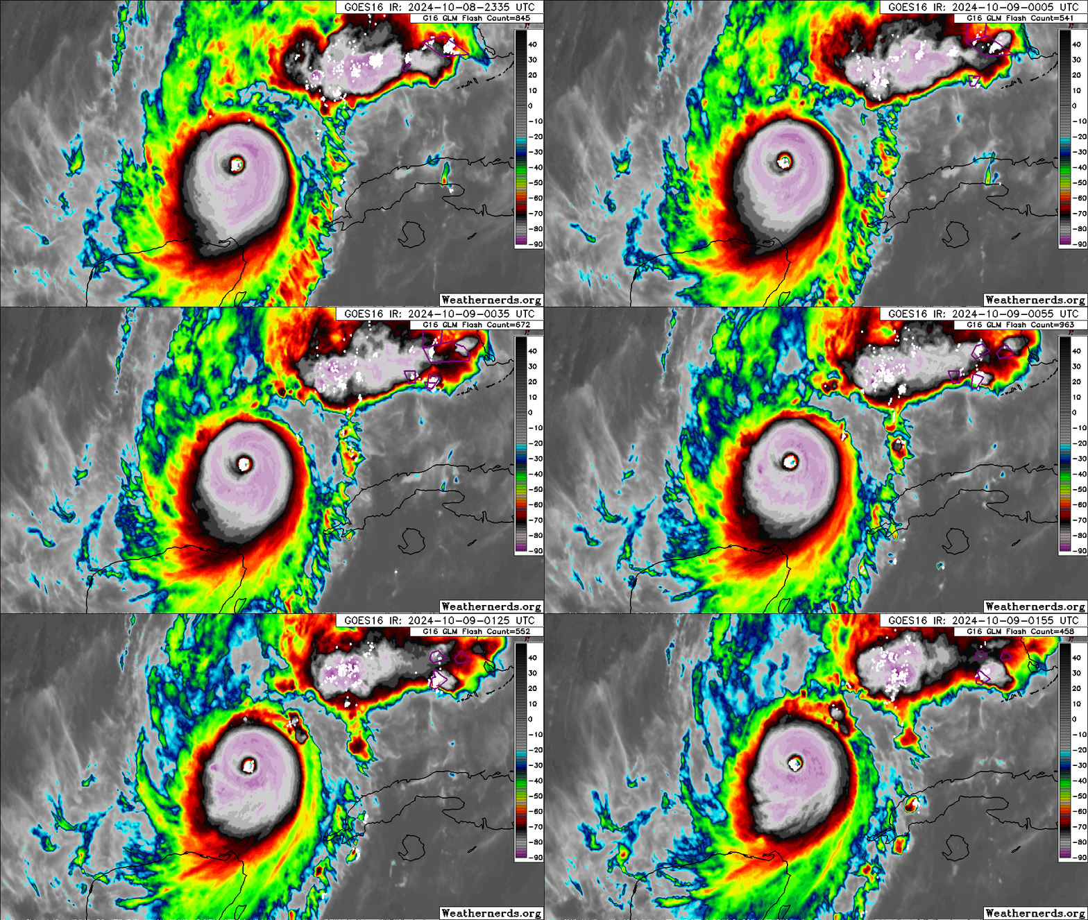
It's beautiful and frightening at the same time. Unfortunate that it won't just fade away over the ocean and only disrupt the shipping lanes.They don't get to look much better than this...
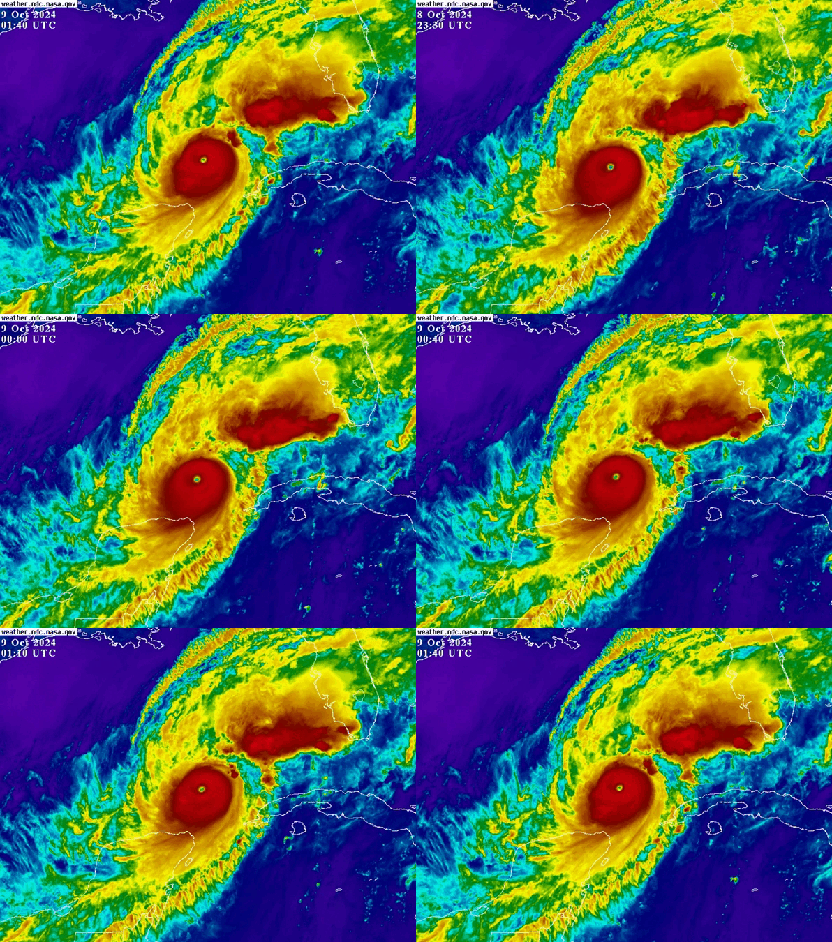
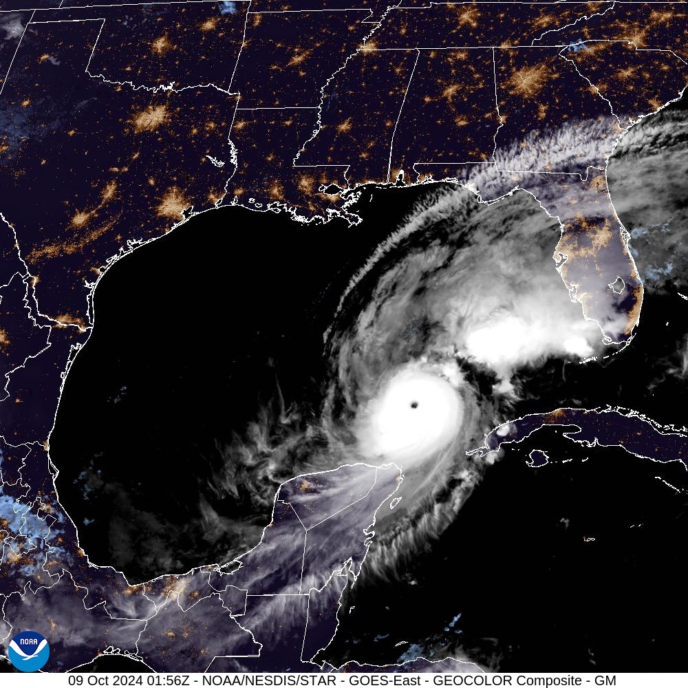
That huge plume of thunderstorms out ahead of the hurricane is an interesting feature.
People on weather forums are calling it the backpack. There's a crazy amount of lightening in it. That'll reach shore well ahead of the main event.That huge plume of thunderstorms out ahead of the hurricane is an interesting feature.
Sorta. When Sally hit Orange Beach Al my motorhome was sitting in OB. Sally was supposed to come ashore further west in Louisiana and I wasn’t concerned. The day before landfall I was working in north Ms helping someone move. Sally kept shifting east so about 3 pm I left home in north Ms heading to OB. I arrived after dark in a sideways rain. I put on a swimsuit and a scuba mask and hooked up my tow vehicle to head out back to north Ms. I dried off and put on some dry clothes. There was no way I was crossing the I10 bay bridge in a rolling billboard with that wind so I went back roads north through Alabama and then crossed over to Hwy 45 in Ms around Quitman. Oddly enough by the time I drove about 50 miles inland the sky was clear and the stars were out. Very little traffic on the roads. The eye wall came ashore early the next morning.This brings up an interesting thought...has anyone ever had to bail out in a hurricane?
I know the pilot. He's a State meteorology grad
That was my first attempt at chasing a hurricane. I drove down and was set up in Mobile when it kept shifting east. I opted not to move east since it was my first hurricane. It was still eery sitting on top of the parking garage in 50-70mph winds watching all the transformers blow across the city.Sorta. When Sally hit Orange Beach Al my motorhome was sitting in OB. Sally was supposed to come ashore further west in Louisiana and I wasn’t concerned. The day before landfall I was working in north Ms helping someone move. Sally kept shifting east so about 3 pm I left home in north Ms heading to OB. I arrived after dark in a sideways rain. I put on a swimsuit and a scuba mask and hooked up my tow vehicle to head out back to north Ms. I dried off and put on some dry clothes. There was no way I was crossing the I10 bay bridge in a rolling billboard with that wind so I went back roads north through Alabama and then crossed over to Hwy 45 in Ms around Quitman. Oddly enough by the time I drove about 50 miles inland the sky was clear and the stars were out. Very little traffic on the roads. The eye wall came ashore early the next morning.
That worries me. It may affect how much rain they'll get before the event startsThat huge plume of thunderstorms out ahead of the hurricane is an interesting feature.
My thought was could that steal some of the energy potential of the ocean ahead of the hurricane.That worries me. It may affect how much rain they'll get before the event starts
Good luck.....no way I'd live in a state with 25 million that should only have about 10-15 million max.We’re just north of Tampa and getting ready. Shutters put up and hoping it veers south and weakens. It’s nothing but red and yellow heading north on every road here. Luckily our house was just built a few years ago so it’s got all the coding to withstand a Cat 3. It is going to be bad wherever it hits.
This was last week, cannot imagine today and tomorrow. Howard Franklin bridge Tampa to St Pete.
This was last week, cannot imagine today and tomorrow. Howard Franklin bridge Tampa to St Pete.
Nevermind. I’m an idiot
This was last week, cannot imagine today and tomorrow. Howard Franklin bridge Tampa to St Pete.
That video is terrifying.
You apparently would have stormed out of my elective Physical Geography class in Hilbun back in Spring 07 and withdrawn in disgust.Do you really think climate scientists are this selfish and so ignorant that they are unaware that earth's climate has changed over time? Is this something we should tell them? Do you really think scientists are gonna read this and say "oh shite, I didn't know that. All those years of education wasted." Climate changes from natural disasters have devastated some societies and the little Ice Age was unpleasant for lots of people. Try not to confuse science with public policy and conspiracies about taxes and redistribution pushed by some far lefties.
Because in the home of our own nationally renowned Meteorology department, other causes of climate change were being taught and discussed. So the thinking is not universal.
We are approaching climate change entirely the wrong way. I don't think we will be able to stop it even IF it is entirely human caused. We need to be spending the money we are wasting now on coming up with ways to mitigate the inevitable effects from it.
We used to vaction down there too. I haven't been in been in over 10 years but the house we used to stay at is still in the family. It survived the last one with minor damage, but the surge where it is was only 4-5 feet. 15 feet will wipe that island clean.Looks like Ft Myers area might get the worst right now. Used to vacation at Sanibel Island and it still hasn't recovered from Ian, so it might be gone after a 15 ft surge.
Last edited:
10:30 am along I-75, Alligator Alley...
Damn. That's not a little spin up liked you'd expect with a tropical system
Can you just imagine the total amount of energy this storm contains ?My thought was could that steal some of the energy potential of the ocean ahead of the hurricane.
I've gotten addicted to the storm discussion forums. The technical aspect is way over my head but I'm picking up that a lot if these storm nerds are not convinced that it will track south of Tampa Bay. There are a couple of favored models that still have it going right through the bay. From what I gather it will come down to how much energy it loses. If it degrades, expect that turn to the right and impact closer to Sarasota or further south. If the hot water closer to the coast lets him keep his intensity the further north it'll track.
Wild that it may come down to just a handful of miles. TB may fare better than it did during Helene if it tracks a just a few miles south. It might look more like the MS coast after Katrina if it tracks just a few miles north.
Wild that it may come down to just a handful of miles. TB may fare better than it did during Helene if it tracks a just a few miles south. It might look more like the MS coast after Katrina if it tracks just a few miles north.
The ICON model was the only one that had Ian coming in as far south as it eventually did. They have shifted their forecast back to right through Tampa for Milton . The Euro model has also.I've gotten addicted to the storm discussion forums. The technical aspect is way over my head but I'm picking up that a lot if these storm nerds are not convinced that it will track south of Tampa Bay. There are a couple of favored models that still have it going right through the bay. From what I gather it will come down to how much energy it loses. If it degrades, expect that turn to the right and impact closer to Sarasota or further south. If the hot water closer to the coast lets him keep his intensity the further north it'll track.
Wild that it may come down to just a handful of miles. TB may fare better than it did during Helene if it tracks a just a few miles south. It might look more like the MS coast after Katrina if it tracks just a few miles north.
Pressure is coming up and winds (145mph) are coming down so all good signs. It just won't have time to come down to a level where impacts are not too bad. We're already seeing it producing tornadic supercells across FL. If people haven't evacuated then they're basically out of time. It would be better to try and ride it out in your house than in your car stuck on the highway unless you're in the storm surge zone.
Do you have any free way of looking at the detailed ICON model? I see it on tropical tidbits but it's at a very zoomed out levelThe ICON model was the only one that had Ian coming in as far south as it eventually did. They have shifted their forecast back to right through Tampa for Milton . The Euro model has also.
THIS is the right answer. We do need to make reasonable changes to produce cleaner energy, but we have to realize there's only so much you can do on that front. You will never get to net zero emissions no matter how much money you throw at it and how much you wreck the economy. The focus needs to mainly be on mitigating the effects.We are approaching climate change entirely the wrong way. I don't think we will be able to stop it even IF it is entirely human caused. We need to be spending the money we are wasting now on coming up with ways to mitigate the inevitable effects from it.
Hopefully the eye stays south of the bay, that could make a huge difference in flooding.The ICON model was the only one that had Ian coming in as far south as it eventually did. They have shifted their forecast back to right through Tampa for Milton . The Euro model has also.
Do you have any free way of looking at the detailed ICON model? I see it on tropical tidbits but it's at a very zoomed out level

Ventusky - Live Weather Forecast & Radar Maps
See the weather like never before – live weather maps powered by the most accurate models.
I like windy.com. Lots of features.Do you have any free way of looking at the detailed ICON model? I see it on tropical tidbits but it's at a very zoomed out level
We also need to stop building such fragile structures in risky areas and having the insurance risk subsidized via increased costs (higher premiums in less risky areas, taxes, etc) to others. I'm fine with the development - just don't spread the risk to others who don't choose to live there.THIS is the right answer. We do need to make reasonable changes to produce cleaner energy, but we have to realize there's only so much you can do on that front. You will never get to net zero emissions no matter how much money you throw at it and how much you wreck the economy. The focus needs to mainly be on mitigating the effects.
Infrastructure improvements in already developed areas are necessary as well. I'm more comfortable with shared costs on that as it will better protect general industry and port activities that need to be in riskier locations. That's a benefit to all.
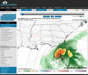
The ICON is available on Pivotal Weather. It was really close on Francine and Helene.Do you have any free way of looking at the detailed ICON model? I see it on tropical tidbits but it's at a very zoomed out level
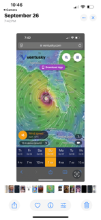
After Helene hit what eventually became Milton was floating around in the Carribean and the models were all over the place. At one time it had it as a very strong storm hitting NO but I didn’t take a screenshot. I did take one here though. The timing was off but the track was pretty close.
Ventusky - Live Weather Forecast & Radar Maps
See the weather like never before – live weather maps powered by the most accurate models.www.ventusky.com
Attachments
Models have a very hard time determining the track until the system develops a defined center of circulation. They can tell something appears likely to develop, but that is about it. That's why I hate when some of these social media sites put out a graphic of the GFS 200 hours out hyping up a massive storm forming and hitting such and such area. Using fear for clicks is a pure dick move. Too many people in this area are genuinely terrified of hurricanes and tornadoes and when they see this it sends them into a panic.After Helene hit what eventually became Milton was floating around in the Carribean and the models were all over the place. At one time it had it as a very strong storm hitting NO but I didn’t take a screenshot. I did take one here though. The timing was off but the track was pretty close.
Absolutely. I have been lucky not to panic in all the years down here. I have a neighbor that has been here for decades and was here for Ivan. We have been lucky with only Sally really doing anything in my time but when there is a threat I pay attention to him. All the newbies will board up, but until he does, I will not either. When we have a yellow I like to look at the long range models and if there is a chance do the small things ahead of the madness I do them before everyone starts panic buying gas especially the landscaping companies.Models have a very hard time determining the track until the system develops a defined center of circulation. They can tell something appears likely to develop, but that is about it. That's why I hate when some of these social media sites put out a graphic of the GFS 200 hours out hyping up a massive storm forming and hitting such and such area. Using fear for clicks is a pure dick move. Too many people in this area are genuinely terrified of hurricanes and tornadoes and when they see this it sends them into a panic.
Update: Houseboat Guy secured it as best he can and has evacuated.
“It’s not THAT the wind is blowing, it’s WHAT the wind is blowing…Update: Houseboat Guy secured it as best he can and has evacuated.
If you get hit with a Volvo, doesn’t matter how many sit-ups you can do”
-RW
You mentioned climate change and multiple causes, including some, but not all, being human activity. I agree that climate change is happening, as the MSU meteorology dept acknowledges, and there's not one single cause. Not sure what your comment is for because mine is not an extremist, unscientific stance. That is, I'm not saying climate change is gonna doom us all, that it's caused only by human activity, nor do I believe that it's no big deal because the climate has always changed. Except when I'm sarcastic, I try to avoid simplistic binaries.You apparently would have stormed out of my elective Physical Geography class in Hilbun back in Spring 07 and withdrawn in disgust.
Because in the home of our own nationally renowned Meteorology department, other causes of climate change were being taught and discussed. So the thinking is not universal.
Last edited:
